Tax Maps
Real Property Maps
The mapping of Hawaii was initiated in 1917 with the appropriation Act. A Branch was created for the purpose of making maps for the use of the tax assessors.
In 1932, a comprehensive plan for a coordinated mapping system was adopted. Its project included the mapping of the entire land area of the stat, drawing all tax maps on sheets of uniform size, and the creation of a key system. The key system provided for the accounting of all properties based on location, boundaries, area and ownership.
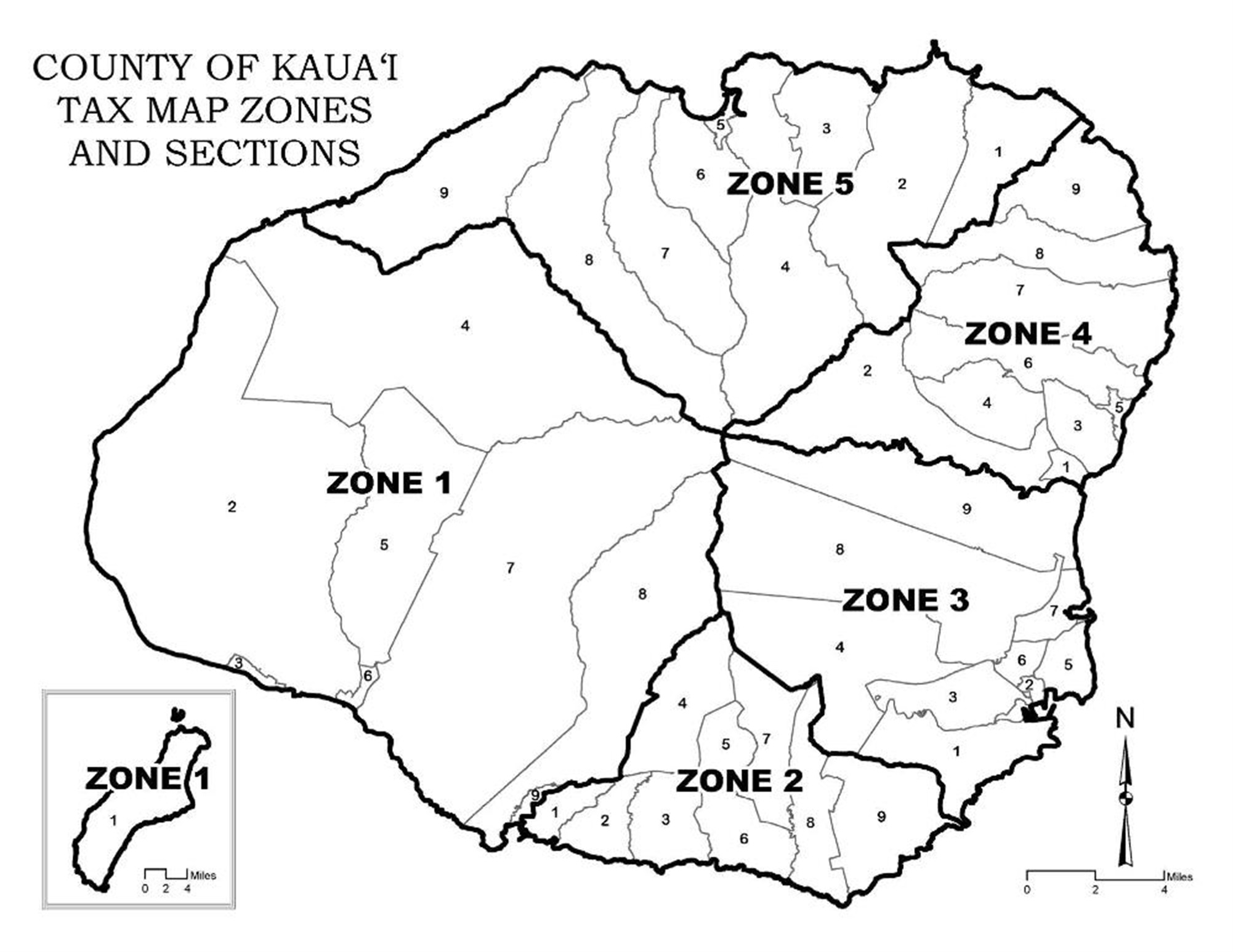
The state was divided into four tax districts. This can be seen on the statewide(GIF, 50KB) map. The island of Kauai was designated as the Fourth Tax District of the State of Hawaii. The island of Kauai map was further broken down into five zones (shown in the map below).
Printed Plat maps can be obtained directly from the Real Property Assessment Office by placing an order.
Open map order form in new window(PDF, 468KB)
Browse & download digital Plat maps
The first two numbers of Plat maps refer to Zone and Section, and the last two numbers indicate the Plat.
ZONE 1 - WAIMEA
ZONE 2 - KOLOA
ZONE 3 - LIHUE
ZONE 4 - KAWAIHAU
ZONE 5 - HANALEI